
PART 8
By
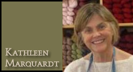
Kathleen Marquardt
October 2, 2012
NewsWithViews.com
Much is written about the international cold war, but little about the incognito warfare on United States soil which public officials and their accomplices are waging to wrest private property from landowners. Jo Hindman, 1972, Blame Metro, p31.
Objectives
10.5 The broad objective is to facilitate allocation of land to the uses that provide the greatest sustainable benefits and to promote the transition to a sustainable and integrated management of land resources. In doing so, environmental, social and economic issues should be taken into consideration. In more specific terms, the objectives are as follows:
(a) To review and develop policies to support the best possible use of land and the sustainable management of land resources by not later than 1996. Agenda 21, Earth Summit, p.85
Today (1995), some 70 years after (Herbert) Hoover‘s committee drafted the standard acts,[1] another, similar effort is taking place: the American Planning Association’s GrowingSmart project.[2]
In Part 6, I discussed the Transect which is a system to divide the land of our country (and the world) into the Wildlands devised by Arne Noss (deep ecologist) and Dave Foreman (radical environmentalist), but under deceptive, seductive names. You can read how a New Urbanism posted story titled “Transect applied to regional plans,” describes it:
“The Transect has six zones, moving from rural to urban. It begins with two that are entirely rural in character: Rural preserve (protected areas in perpetuity); and Rural reserve (areas of high environmental or scenic quality that are not currently preserved, but perhaps should be). The transition zone between countryside and town is called the Edge, which encompasses the most rural part of the neighborhood, and the countryside just beyond. The Edge is primarily single family homes. Although Edge is the most purely residential zone, it can have some mixed-use, such as civic buildings (schools are particularly appropriate for the Edge). Next is General, the largest zone in most neighborhoods. General is primarily residential, but more urban in character (somewhat higher density with a mix of housing types and a slightly greater mix of uses allowed).
At the urban end of the spectrum are two zones which are primarily mixed use: Center (this can be a small neighborhood center or a larger town center, the latter serving more than one neighborhood); and Core (serving the region — typically a central business district). Core is the most urban zone.” (ital. mine)
Michael Coffman’s Wildlands Map, calls the zones by different names (protected instead of rural preserved, corridors for rural reserve, etc) but the results are the same: people in cages and animals having the run of the country, with 50% of American land off limits to humans.
How is all this to be done? According to Agenda 21, by “Promoting application of appropriate tools for planning and management
10.8 Governments at the appropriate level, with the support of national and international organizations, should promote the improvement, further development and widespread application of planning and management tools that facilitate an integrated and sustainable approach to land and resources.” One of the tools, of course, is SmartCode.
SmartCode is defined in a pamphlet of 72 pages; there is no way all of it can summarize all of it in this article but I am going to give some highlights (?) (in ital) with page numbers so you can look them up with the accompanying information:
• The provisions of this Code, when in conflict, shall take precedence over those of other codes, ordinances, regulations and standards except the local health and safety codes. p2 In other words, this code is to be the law of the land, both literally and figuratively.
• INTENT
The Region a. that the region should retain its natural infrastructure and visual character derived from topography, woodlands, farmlands, riparian corridors and coastlines. b. that growth strategies should encourage Infill and redevelopment in parity with new communities. p2 In real terms, build in the cities (up when you can’t go out), but have the rest of the area as pristine as possible, no matter how many homes you have to raze.
The Community
• that neighborhoods and regional centers should be compact, pedestrian-oriented[3] and Mixed use.
• that neighborhoods and regional centers should be the preferred pattern of development and that Districts specializing in a single use should be the exception.
• that ordinary activities of daily living should occur within walking distance of most dwellings, allowing independence to those who do not drive. Think about how cities like Knoxville, Los Angeles, even Bethesda, MD, will have to be almost totally redeveloped to achieve this goal. The costs will be astronomical. (Consider also the psychological cost of everyone having to live identically to everyone else.)
• that the region should include a framework of transit, pedestrian, and bicycle systems that provide alternatives to the automobile.
The Block and the Building
• that civic buildings should be distinctive and appropriate to a role more important than the other buildings that constitute the fabric of the city. Reminiscent of Nazi German: government is the most important entity thus their buildings should reflect that sentiment.
• that the harmonious and orderly evolution of urban areas should be secured through form-based codes. p3 I recommend that you check out The Ideal Communist City by Alexei Gutnov et al. to see what is envisioned to replace our often beautiful, sometimes eclectic cities and towns; harmonious and orderly means cookie-cutter, stack-em and pack-em buildings with zero personality. Forget gingerbread, forget picture windows; even a Potempkin Village is out of the realm of our new reality.
• that the transect Zone descriptions on table 1 shall constitute the intent of this code with regard to the general character of each of these environments. p4.
TAKE NOTE
• twenty years after the approval of a regulating plan, each transect Zone, except the t1 natural and t2 rural Zones, shall be automatically rezoned to the successional (next higher) transect Zone, unless denied in public hearing by the legislative body. p 5. Read that closely; after 20 years of Sustainable Development there will be far few humans, thus the space set aside for their habitation can be reduced, eventually eliminating all areas of habitation except the infill growth sector (core); the other zones will eventually revert to t1 and t2, wildlands and corridors.
• regional plans shall integrate the largest practical geographic area, overlapping property lines as necessary and municipal boundaries if possible. p5. (led by unelected councils)..
• the areas to be designated preserved open sector (o-1) shall be mapped using the criteria listed in section 2.3. the outline of this sector is effectively the rural boundary line, which is permanent. (bold, mine) p6. It is only permanent vis a vis human encroachment; the line with be drawn ever outward as humans are removed.
• A system for the gradual transfer of Development rights (tDr) shall be established and administered for the purpose of transferring development rights from the reserved open sector (o-2) to the Growth sectors as set forth in section 2.4.3.
• the preserved open sector shall consist of open space that is protected from development in perpetuity. (bold, mine)
• the preserved open sector includes areas under envi-ronmental protection by law or regulation, as well as land acquired for conservation through purchase, by easement, or by past transfer of Development rights. p6
• the reserved open sector shall consist of open space that should be, but is not yet, protected from development. p7. (Like PacMan they will get to it eventually.)
• the reserved open sector is a transfer of Development rights (tDr) sending area, for the gradual sale of rights for development in the controlled Growth sector and the intended Growth sector. An owner who has purchased such development rights may exceed the allocated Densities of new communities as set forth in section 3.8 and table 14b. Areas from where development rights have been transferred shall be designated Preserved Open Sector.The Planning Office shall maintain a record of such transfers, updating the regional map accordingly. p7
• the restricted Growth sector shall be assigned to areas that have value as open space but nevertheless are subject to development, either because the zoning has already been granted or because there is no legally defensible reason, in the long term, to deny it. (bold, mine) Within the restricted Growth sector, clustered land Development (clD) shall be permitted by right. p7.
• lawn shall be permitted only by Warrant. p13. (This doesn’t mean you can plant a garden where your lawn once was.)
• the public Frontage shall include trees planted in a regularly-spaced Allee pattern of single or alternated species with shade canopies of a height that, at maturity, clears at least one story. p13. (Look at the plans, they dictate where trees are to be placed and which species are allowed.)
• Designations for Mandatory and/or recommended retail Frontage requiring or advising that a building provide a Shopfront at Sidewalk level along the entire length of its private Frontage. the shopfront shall be no less than 70% glazed in clear glass and shaded by an awning overlapping the Sidewalk as generally illustrated in Table 7 and specified in Article 5. The first floor shall be confined to retail use through the depth of the second layer. p14.

There is so much more and you can download the entire SmartCode, go about halfway down the page linked here.
We Americans (and the rest of the world, yes, but right now I am most concerned about the fate of the once freest country every conceived by man) are being forced, incrementally, into slavery or death. So many good, well-meaning people say, “Don’t worry, when they come for my property I will meet them with my guns.” If only it were that simple.
|
|
Instead we are being moved out of our property through fees, taxes, regulations and zoning. By the time the powers-that-be decide it is time to bring out the guns, most of us will not be living that once-great American Dream with a car in every garage and a chicken in every pot. We will be in high-density, stack-em and pack-em housing sharing our meager food and water (if we have any) with too many other people as well as rats and other vermin.
This is probably our last chance to stop Agenda21 Sustainable Development and the global elites. We must do it at the local level, halting the regionalization before it becomes what it is intended: socialism, communism, whatever.
I watch my neighbors buying more and more toys and fancier cars, adding ever more elaborate detailing to their heavily-mortgaged homes and enjoying the mindless pleasures offered them by mainstream media. Ignorance might be bliss at this moment, but what will it be like when the financial collapse hits?
May the Lord help us, we don’t seem to be doing the job.
Click here for part -----> 1, 2, 3, 4, 5, 6, 7, 8,
� 2012 Kathleen Marquardt - All Rights Reserved


 Share
This Article
Share
This ArticleKathleen Marquardt has been in the freedom movement since before it was called that. She was founder and chairman of Putting People First, a non-profit organization combatting the animal rights movement. Her book, AnimalScam: the Beastly Abuse of Human Rights, was published by Regnery in 1993. Kathleen has been Vice President of American Policy Center since 2000 and is the Agenda 21/Sustainable Development expert for Rocky Top Freedom Campaign. She is a contributing writer and researcher for Freedom Advocates.
Website: www.rockytopfreedom.com
E-Mail: marquardtkathleen379@gmail.com